When explorers name places after animals or objects, often we are left to wonder how long they had been walking in the sun (Cradle Mountain? Maybe if you squint. Frenchman’s Cap? Uh, sure). But when Hume and Hovell came across a giant lump of granite on their way to Port Phillip in 1824 and called it Mount Buffalo, you can see what they had in mind. Rising separately from the rest of the Victorian alps is a giant lump of granite that from a distance does indeed look like a sleeping buffalo with knobs and bumps that could be shoulders or hips, bookended at one end by the clear point of the buffalo’s horn and at the other the giant cleft of … well, you get the idea.
The plateau, once part of the sea bed, rises up to 1500 metres from the surrounding farmland 50km from the Great Dividing Range near Bright in north-east Victoria. Long before Hume and Hovell arrived, the Minjambuta people are believed to have climbed to the top in summer to feast on the protein-rich Bogong moths. European settlers tried cattle grazing and mining on the plateau but Mount Buffalo has a long conservation history. In the late 19th Century guides were taking visitors up the mountain to enjoy the unique alpine scenery and in 1898 it became one of Victoria’s first national parks (along with Wilsons Promontory) after lobbying by the Bright Alpine Club.
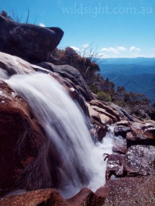
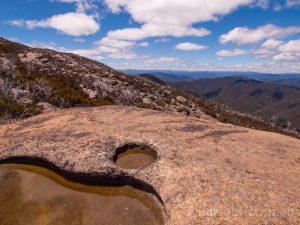
There are more than 90km of walking tracks that explore a spectacular landscape of granite tors, snowgrass plains, alpine ash and showgum forests dissected by creeks, many of which plunge over the cliffs at the plateau’s edge to the valley hundreds of metres below. The size of the plateau (31,000 hectares) limits the length of bushwalking expeditions to a couple of days at most but its isolation creates a unique landscape where you can walk for a few hours and feel like you’re the only person on the plateau. And the compact size means all the best spots are easy to get to.
The Cathedral (2km, 1 hour)
Start/Finish: The Cathedral car park
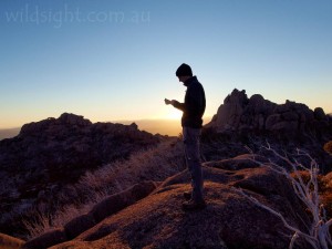
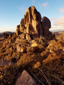
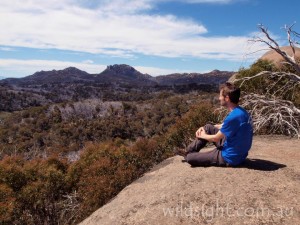
This walk is short and heavily constructed but the single most striking feature of the plateau shouldn’t be missed – and you will work up a sweat. The track follows stone steps on increasingly steeper switchbacks for 500 metres to reach the base of The Cathedral, a pile of huge boulders that towers over the track. The path then veers left and continues up The Hump, the hill next to the Cathedral that is higher but has a somewhat less inspiring name. A final scramble up a rock gully leads to the exposed summit and commanding views over the Cathedral and most of the plateau. This is a great spot to watch the sun set (remember to bring a torch so you can find your way down).
The Gorge, The Monolith and Haunted Gorge (8km, 3 hours)
Start/Finish: Lake Catani campground
A terrific half-day circuit from the Lake Catani campground that visits all the best features of the eastern end of the plateau, including the giant cliffs of The Gorge (there is a car park at the Gorge if you are pressed for time, but this is much more fun). Starting at the picnic shelter walk for 500 metres on a wide path that passes a dam wall (the lake was created when the creek was dammed in 1910) before reaching a bridge. Turn off just before the bridge on to the View Point Nature Walk. Ignore a turnoff to the Underground River (you’ll be going there a little later) and climb steadily through alpine ash forest to a final rock scramble to View Point for excellent views from the edge of the plateau over the farmland of the Buckland Valley.
Return via the same track and turn off on the path to Underground River. The track drops steeply into Haunted Gorge to cross the river – between the rocks is the entrance to the unseen river; only cavers with the right gear and experience can continue. But it’s interesting to take a peek at the rushing water before climbing out of the gorge then following a pleasant trail through the forest to Billisons Lookout for more views (there is a seat if you need a rest). From here it’s 300 metres to the major car park for day visitors to The Gorge and the Mount Buffalo Chalet. The chalet hosted visitors for over a century before closing after the 2007 bushfires – work is underway to reopen it as a day visitor facility in 2016. Until then a coffee van operates in the car park (bring some loose change!).
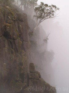
Don’t miss the view from Bents Lookout of the sheer 300-metre cliffs of the North Wall of the Gorge and the Victorian Alps beyond – a sign helpfully points out the major peaks – before continuing north to pick up the Gorge Heritage Walk. There are a few more viewpoints before reaching a bridge where the path crosses Crystal Brook just before the creek plunges over the cliffs. Turn around here and return to the southern end of the car park to pick up the wide path to Lake Catani. You aren’t on this for long before reaching another junction – follow the signs to The Monolith for a much more interesting return journey. Turn right at the next two junctions then climb to the giant balancing rock that towers above Lake Catani. A ladder once allowed walkers to climb it; that has been removed for safety reasons but there are excellent views from the base. After enjoying the view return to the main track and turn right. The track winds through forest to Mount Buffalo Road – turn left and walk for 500 metres beside the road to reach the Lakeside Track. Take another left turn here to follow the path along the lake shore to a footbridge below the dam wall at the far end. This returns you to the wide path you started on – the picnic shelter is 500 metres to your right.
The Horn (1km, 45 minutes)
Start/Finish: The Horn car park
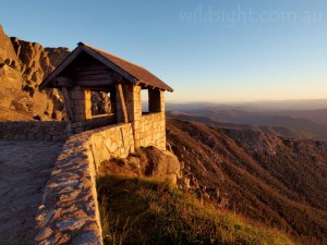
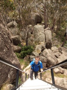
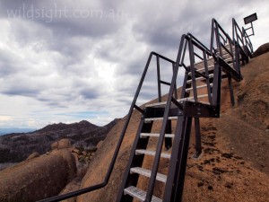
Another short climb, this time to the highest point on the plateau at 1723 metres. A gravel road (closed in winter) ends at a car park where there is a stone shelter and a spectacular view of the cliffs of the Wall of China. The walk is straightforward and includes some rock hopping that is assisted in places, including the final scramble to the top, by metal handrails. The reward is a 360-degree view over the whole park and the ranges beyond – look for the jagged profile of the Crosscut Saw to the south. Bogong moths can be prolific at the top, with hawks and falcons hovering on air currents to take advantage of the feast. This is another fantastic sunset spot. Return to the car park via the same route.
Eagle Point and Mount Dunn (12km, 4 hours)
Start/Finish: The Reservoir Picnic Area
A network of walking tracks lead to a range of viewpoints and interesting rock formations on the north of the plateau with names including The Sarcophagus, Devils Couch and Cheese and Biscuits, which describe their appearance with varying degrees of creativity, and accuracy. Any number of route variations are possible but the walk described here takes in the highlights and forms a nice neat circuit. Start at the picnic area at the end of the unsealed Reservoir Road, which leaves Mount Buffalo Road near the Parks Victoria office. Pass a gate and walk up a wide vehicle track for 500 metres then turn left following a sign to Eagle Point (the vehicle track continues all the way to Mount McLeod). A narrow track negotiates some small hills and passes the southern end of the reservoir to reach a sign marking a side-trip to Og, Gog and Magog (500 metres each way). Arrows on rocks mark a route up a gully to a vantage point on top of a large boulder with excellent views south across the plateau to the Cathedral and the Hump. Return to the main track and turn left.
The path winds through eucalypt forest – wildflowers are a feature in summer – to another track junction; turn right, following the sign towards Eagle Point 1km away. Cross Five Acre Plain to another sign at the start of the side-track to Eagle Point, a wild viewpoint reached via a medal ladder. This spot is 5km and about 1.5 hours from the walk start.
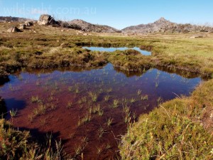
To continue, return to the junction and turn right, then head right again at the next junction to head south-east; the walking here is very enjoyable as the track crosses a large snowgrass plain with wooden duckboards protecting the most sensitive areas. One kilometre from the track junction you will run into the rough Rocky Creek Track – turn left here then right 100 metres down the hill to embark on a counter-clockwise circuit of Mount Dunn.
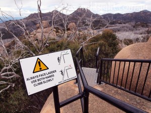
Ignore a turnoff to Macs Point after 500 metres and continue through Giants Causeway. Turn left just before Stanley Rocks (2km from the Rocky Creek Track junction) to link up with the Long Plain Track – turn left here then left again after 500 metres to climb to the top of Mount Dunn. The track follows a series of switchbacks then a combination of steep metal stairs and ladders to the 1510-metre summit. This final section is very exposed – take care, especially in bad weather (in fact, it’s probably not a great spot to be if a storm is brewing). After drinking in another great view, head back down the stairs and switchbacks to the junction. Turn left and after 500 metres the track hits the Rocky Creek Track; from here it’s another 500 metres to the Reservoir Road.
Dicksons Falls and Back Wall (13km, 4-5 hours)
Start/Finish: Cresta Valley
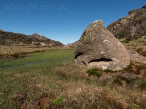
The track to Dicksons Falls is one of the best short walks on the plateau and makes an excellent family excursion. You can turn it into a more serious half-day adventure by continuing to the Back Wall, where the plateau ends in a maze of cliffs and steep gullies. Take advantage of the large car park at Cresta Valley (used by skiers in winter) and walk back up the road for 100 metres to the start of the Dicksons Falls nature walk. Head south on what can only be described as an exceedingly pleasant walk. The track meanders across the snowgrass plains with views west to the Horn framed by snowgums, boulders and alpine bogs. This area is popular with wombats and birds and wildflowers are prolific in summer; several signs explain the natural features.
Pass a turnoff to the Back Wall and continue along the creek to Dicksons Falls lookout where the creek tumbles over a series of cascades before dropping over the cliff to the valley below. The view from the lookout (about 45 minutes’ walk from the road) encompasses the major peaks of the Victorian Alps.
Retrace your route to a sign about the antechinus (a furry local resident) and head left, leaving the path to walk off-track across the plain – head for the pink ski pole and cross a bridge to enter the Valley of the Gods. For the next 1km the route is marked by ski poles which are about 200 metres apart; finding your own way is enjoyable but traversing snowgrass is more tiring than it looks – and take care not to trample sensitive alpine vegetation.
After passing through the valley the snow poles swing north and then double back to the east; somewhere here you will hit the Back Wall track about 750 metres from where it leaves the Dicksons Falls nature walk. Turn left following the track to the Back Wall, a little over 3km away. The path heads south-west, dropping to cross a creek then climbing to a saddle before taking a sharp turn to the left. From here the track deteriorates; stone cairns mark the way in some sections.
The route passes the cliff edge several times before dropping through a gully and hitting a dead end at the edge of the plateau. The view from here is very rugged; the sheer 300-metre drop at the Gorge is replaced by a jumble of cliffs and rocky slopes. Take a break here before returning along the same path all the way to the Dicksons Falls nature walk, turn left here to traverse the final 500 metres to the road.
Chalwell Galleries (1.2km, 30 minutes)
Start/Finish: Lake Catani campground
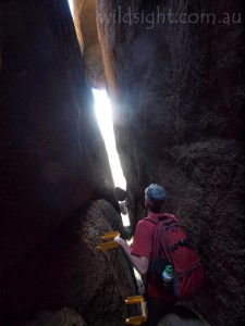
A short, fun trip that starts by back along the road to the campground for about 200 metres to reach the start of a loop walk. Leave the road and climb on a steady, then steep path beside a huge pile of boulders. Then comes the fun part. An arrow indicates where the path disappears beneath the rocks – handrails assist in finding a way through a narrow fissure between the two biggest boulders – several other rocks are jammed in the gap, which is only about a metre wide. After emerging on the southern side of the galleries, turn right to complete the circuit and walk back up the road to the campground. The Old Galleries, a few hundred metres up the Mount Buffalo Road (on the way to the Cathedral), offer a similarly enjoyable experience on a slightly smaller scale.
Ladies Bath and Eurobin Falls (2km, 45 minutes)
Start: Eurobin Falls picnic area
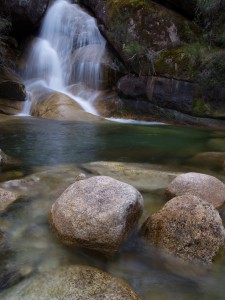
A walking track starts 200 metres up the road from the picnic area, next to a pull-off area. It climbs gently for about 500 metres to Ladies Bath Falls, which plunge into a large pool in a beautiful setting of boulders and tree ferns. Some time can be spent enjoying this magical spot before continuing on a steeper track to a viewpoint overlooking the larger Eurobin Falls, which flow over a steeply sloping expanse of rock. Stay on the track – several people have suffered serious injuries trying to climb the falls. Return on the same track to the walk start – a very pleasant spot for lunch.
Rocky Creek (13km, 2 days)
Start/Finish: The Reservoir Picnic Area
One of two overnight hikes on the plateau – neither are particularly long and they could be completed in a long day, but then you miss out on the fun of camping out in this beautiful part of the world. Follow the notes above to Eagle Point and continue west from the lookout turnoff. The track passes through more forest then crosses Molison Plain to reach a turnoff to Mollisons Galleries. Take the 1km detour to visit another pile of boulders with fantastic views over wild untracked country to the north. Return to the junction; from here the main track turns south and drops steeply for 2km to cross Rocky Creek and hit the Rocky Creek Track, which doubles as a cross-country ski trail. Turn right and walk for 1km to the Rocky Creek camping area; there is room for 3-4 tents and water is available from the creek. The campground is 8.5km from the picnic area.
Day two is spent walking back to the car park along the Rocky Creek Track, a direct journey of about 7km. If you’re not in a hurry make things more interesting by turning left after 4km to climb to the lookout at Macs Point (leave packs at another junction below the summit). Instead of returning to the Rocky Creek Track, turn right below Macs Point to head to Split Rocks and another track junction at Giants Causeway – turn right here to join the circuit of Mount Dunn described above. This scenic route adds up to about 13km.
Mount McLeod (17km, 2 days)
Start/Finish: The Reservoir picnic area
Mount McLeod is the highest point on an isolated corner of Mount Buffalo, separated from the main part of the plateau by the Buffalo Creek Valley. The result is a delightful walk with an air of wilderness that can’t be matched anywhere else in the park.
From Reservoir Road follow the Mount McLeod ski trail, which is essentially a closed vehicle track when not covered by snow, through the forest to the signposted shortcut track. This provides a nice break from the road bash, winding through impressive forest in the headwaters of Buffalo Creek. After rejoining the main track, cross the creek and continue northeast below Andersons Peak then up a long ridgeline with occasional views through the trees of surrounding tors and rocky peaks. 6.5km from the walk start the track reaches Dels Plain, the designated hikers camping area.
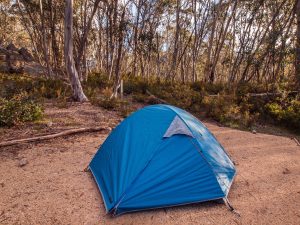
The Plain is everything you might hope for in an alpine campsite: soft snowgrass to pitch your tent, shelter from the surrounding snowgums and a composting toilet to boot. There is even water in the small creeks in the plain, although you should check with rangers before you go to make sure it’s flowing, and boil or treat it before drinking. Mount McLeod is another kilometre from the campsite – continue up the trail, which transforms into a walking track as it ascends the mountain. The views really open up here and as you reach the summit you’re treated to uninterrupted views of the entire plateau and, to the north, the very distant-looking settlements of the Ovens Valley. Return to camp and the next day follow the trail back to the walk start.
OTHER THINGS TO SEE AND DO
Besides bushwalking the other major outdoor activity at Mount Buffalo is rock climbing – this is one of the best places in Australia for vertical cliffs including the epic 300-metre North Wall of the Gorge. Lake Catani is a great spot for some less exhilarating pursuits including swimming and canoeing in summer, or just having a picnic by the lake.
FLORA AND FAUNA
The plants and animals of the plateau are mostly familiar to visitors to the Alps but come – like everything up here – with a unique twist. Wombats are common and swamp wallabies are also regularly spotted by walkers. Greater gliders and eastern pygmy possums are active at night but harder to spot. Crimson rosellas and gang gang cockatoos are commonly seen along with smaller birds like the striking flame robin. The park is home to a surprising variety of eco-systems ranging from snow gum woodland to sphagnum moss beds. Wildflowers produce an explosion of colour especially in early summer.
ACCESS
Mount Buffalo is 325km from Melbourne – follow the Hume Highway to Wangaratta then signs towards Bright. A winding road to the top turns off the Great Alpine Road at the small town of Porepunkah (7km from Bright). Allow about four hours to drive from Melbourne; from Porepunkah it’s about half an hour to the top.
WEATHER
In winter the plateau is covered by a blanket of snow which limits bushwalking opportunities but the sightseeing is fantastic and it’s a great spot to bring snow shoes, a toboggan or cross-country skis – there are 14km of groomed trails and a further 20km of remote cross-country trails. There is even a ski lift or two at Cresta Valley and the best part is that unlike most alpine resorts, park entry is free.
In summer temperatures are usually a few degrees cooler than at sea level which usually makes for pleasant walking, although extremely hot days are still possible – wear sunscreen and drink plenty of water. Fire is the other danger – the park suffered major damage from a large bushfire in 2007.
CAMPING AND ACCOMMODATION
There is a large camping area beside Lake Catani that is open for car-based camping from November to April. A small number of sites are available for snow camping in winter. There is a toilet and shower block in the middle of the campground. Remote bush camping is available at Rocky Creek and Mount McLeod for a limited number of hikers. Bookings are required for all campsites.
SAFETY/WARNINGS
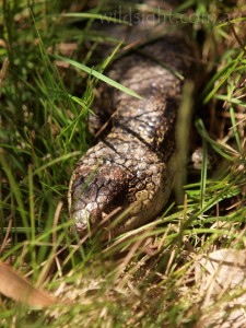
Many tracks are near cliffs – follow signs, stay behind barriers and use commonsense. Bushfire warnings should also be heeded. Most wildlife is happy to go about its business if undisturbed but be aware there are venomous snakes in the park, including copperheads.
TRACKS
Most of the track network is extremely well graded but paths can be a bit rougher in more remote parts of the park. In some places rock cairns mark the route and some of the most enjoyable walks involve following arrows over, between and under boulders. Many of the most exposed peaks have metal ladders and fences but don’t let the intrusions spoil the wilderness atmosphere. The Spatial Vision Mount Buffalo 1:30,000 map covers the whole park and has lots of useful info on the back.
MORE INFORMATION
Book a campsite online at www.parkstay.vic.gov.au or with Parks Vic on 13 1963.
These descriptions are a guide only. While we have made every effort to make them accurate, we accept no responsibility for any loss, injury or inconvenience sustained while using them. Make sure you use an up-to-date map and consult rangers before heading out.
