4 DAYS, 38.2km
The Tasmanian wilderness is rightly considered to be one of the world’s great hiking destinations and one of the highlights of the region is Walls of Jerusalem National Park, where hikers can spend anything from a weekend to a week exploring dense forests, craggy mountains and wild alpine valleys. The route described here samples the highlights of the area, including climbing the three highest peaks and exiting via a procession of ice-carved lakes.
Day 1: Mersey Valley to Wild Dog Creek (6.3km 3-4 hours)
The track begins at a small dirt car park located off the Mersey Forest Road, and there is a small sign-in booth close to the start of the track, so make sure you register your details (although you will still need to let someone back home know when you’re expected back so they can notify the authorities if you don’t return on time).
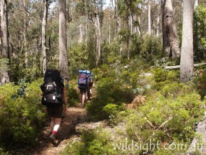
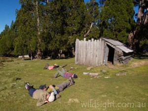
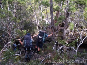
From the registration booth the track immediately begins its 2km, 550-metre ascent of the Central Plateau, angling steeply up through the forest. About two thirds of the way to the top it passes Trappers Hut, built in the mid-20th Century by fur trappers and now a convenient spot to rest and catch your breath.
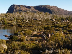
After the hut the track continues climbing (ignore the track that joins from the right) until it emerges quite suddenly from the eucalypt forest and out onto the plateau. It then turns south east, passing a picturesque cluster of lakes known as Solomons Jewels and crossing a boardwalk before ending the day at Wild Dog Creek campsite, your home for the next three nights.
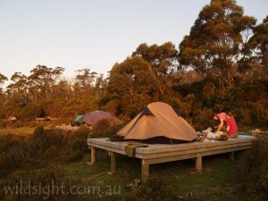
The rangers request that hikers not camp in the main valley of the Walls to avoid causing erosion and pollution, and really there is no reason to with such a good place to stay located just outside. The camp consists of a series of wooden platforms, with a composting toilet and even water piped to your campsite!
Day 2: Wild Dog Creek to King Davids Peak (return) (8km, 5 hours)
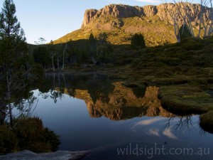
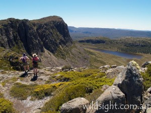
The second day reveals the true magic of this walk, as you get to leave your packs and tent behind and do some real exploring. Your day begins with a short climb to Herods Gate, located between Mount Ophel and King Davids Peak, and the primary entry point into the Walls of Jerusalem, a cluster of five peaks surrounding a wide central valley and separated by narrow mountain passes. The track takes the southern side of the valley past Lake Salome, following the base of a line of cliffs titled the West Wall. Make sure you take the the short side track to the Pool of Bethesda, a very pretty lake located under the rocky slopes of the Temple.
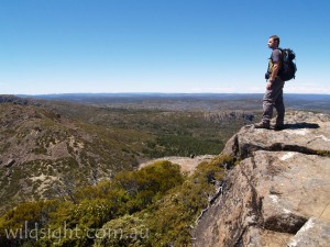
Rejoin the main track and follow it up to a saddle, which is called the Damascus Gate. If the weather is dry take the right fork up to Solomons Throne, which ascends the scree slope created by aeons of erosion of the cliffs above. A final scramble leads to the summit and excellent views of the Central Plateau and the peaks of Cradle Mountain – Lake St Clair National Park to the west.
Many walkers may wish to finish here but experienced groups can continue along the ridge towards King Davids Peak. The track disappears soon into the traverse, leaving you to pick your way along short makeshift paths and over extensive fields of boulders which make for very slow going. Be very careful of the drop to the right – the cliffs are 200 metres high.
Eventually you reach the summit and views that are if anything even better than those from Solomons Throne. The rest of the day is spent retracing your steps back to camp.
Day 3: Wild Dog Creek to Mt Jerusalem (return) (13.4km, 5 hours)
Day three is another pack-free day, this time travelling further afield to the southern-most of the the park’s major peaks, Mount Jerusalem. Initially follow the same track as the day before, but at Damascus Gate continue straight ahead and head downhill through pencil pine forest to Dixons Kingdom. These trees are quite common in the national park, and the grove at Dixons Kingdom is the largest pencil pine forest left in Tasmania (and by extension the whole world); at one time they were much more widespread but they are very sensitive to fire and escaped campfires have taken their toll. For this reason fires are totally banned in the Walls of Jerusalem and hikers are required to use camping stoves.
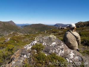
In the depths of the valley lies Dixons Kingdom Hut, built from pencil pine timber by cattleman Reg Dixon. Hikers sometimes camp here (although it is discouraged) and it makes a good spot for a break. The track to Mount Jerusalem heads north then east from this point, climbing up a grassy valley before ascending the rocky slopes of the mountain past a small rocky lake. The views from the summit are fantastic, with literally thousands of lakes visible across the plateau. On a clear day you can see all the way across Tasmania to Precipitous Bluff on the island’s southern coast.
Day 4: Wild Dog Creek to Mersey Valley (12.5km, 5-6 hours)
Note: this day contains sections of off-track walking and is only suitable for parties experienced in navigation. Those wishing to keep to the tracks can retrace the route taken on day one.
Put on your packs (which makes an unwelcome change from the lightweight walking of the previous two days) and head through Herods Gate for the last time, following the track to Dixons Kingdom. From here your route deviates from that of the day before, following the wide valley of Jaffa Vale south and west towards Lake Ball. Much of this area is untracked, and rangers ask walkers to fan out rather than walk in single file to prevent erosion and crushing of the fragile vegetation.
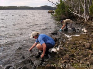
After passing through a large patch of pencil pine forest you will find yourself emerging on the shore of Lake Ball – keep an eye out for the track, which re-starts on the edge of the forest shortly before you reach the lake. The track then follows the lake shore, occasionally leaving the water and heading into forest, and passing the small Lake Ball Hut. It then descends steeply from the end of the lake to the shore of the larger Lake Adelaide, which makes a good lunch spot.
Near the edge of the lake you meet the Junction Lake track, which hardened walkers sometimes take as an alternative access route to the Overland Track (an excellent wilderness walk for parties experienced in multi-day treks across trackless terrain). With a whistful look over your shoulder turn right instead, passing through a rocky valley in the direction of Clumner Bluff, whose cliffs are a constant presence ahead. After another couple of hours the track meets up with the route used on day one, which can then be taken back to the car park.
NEED TO KNOW
The Walls of Jerusalem, like all alpine areas of Australia, experience sudden weather changes including snowfalls any time of year, so always come prepared with warm clothes and wet weather gear.
The park is located east of Cradle Mountain: head to Deloraine then Mole Creek, taking the route to Mole Creek Caves and then onto Mersey Forest Road, following the signs. The last section is unsealed so allow extra time to drive slowly, and also drive very carefully late at night due to the wildlife on the road.
The area is completely under snow in winter and bad weather can occur at any time of year, so be prepared. This is a multi-day walk and you will need appropriate equipment and supplies; make sure you check with the rangers that you have everything you need before you head out.
OTHER THINGS TO SEE AND DO
The Walls of Jerusalem are located to the east of Cradle Mountain, and in summer when the days are long it is quite feasable to check out Dove Lake in the morning then drive over to the start of the hike in the early afternoon. Also worth investigating close by are the famous Mole Creek caves; 45-minute tours of King Solomons Cave and Marakoopa Cave run every day of the year aside from Christmas Day.
ACCOMMODATION AND SUPPLIES
No car camping is available within the park, but visitors can stay at nearby Mole Creek or Deloraine. Mole Creek has a general store and Deloraine has supermakets, while for the full range of camping supplies its best to stock up at Devonport or Launceston.
MORE INFORMATION
Phone (03) 6363 5133 or visit www.parks.tas.gov.au
These descriptions are a guide only. While we have made every effort to make them accurate, we accept no responsibility for any loss, injury or inconvenience sustained while using them. Make sure you use an up-to-date map and consult rangers before heading out.
