2 DAYS, 18.6km
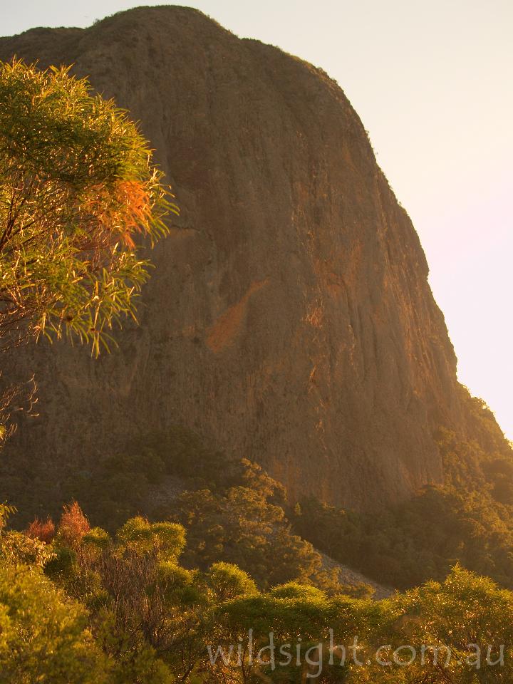
The fantastic landscape of the Warrumbungles in north central New South Wales is all that remains of a massive volcano that last erupted 13 million years ago. At its full height the peak soared a kilometre above the surrounding plains and covered an area of 1,200 square kilometres, but once the eruptions stopped erosion washed away the loose volcanic sediments. What remained were pockets of hardened solidified magma that today form the huge stone pillars, rocky mountains and massive cliffs which make the national park a mecca for walkers from around Australia. Most of these spectacular features are to be found in the area known as the Grand High Tops, which can be traversed in a classic 2-3 day walk.
Day 1: Camp Pincham to Balor Hut (6.8km 3 hours)
The walk starts at the Camp Pincham car park – named after Alfred Pincham, who owned the land covered by the Warrumbungles and donated it to the people of New South Wales in 1952 – initially following a management vehicle track past a large information sign and a set of toilets before arriving at the camp itself after 200 metres. Avoid the turn-off to the camp (which can be used to stay the night before if you are averse to the car camps located elsewhere in the park) and take the track south along the valley of Spirey Creek.

After 1.6km, turn left at the junction with the Gould Circuit. This is much rougher and considerably less travelled than the main track and it makes a nice change to be walking on something other than paving stones. The track climbs steeply through forest to a rock outcrop named Febar Tor, which after a short scramble up a side track reveals the first comprehensive views of the Grand High Tops.

To the left is Belougery Spire, the remains of one of the volcano’s many vents, while the central part of the scene is dominated by the Breadknife, a thin slab of rock 300 metres long, 90 metres high and only a couple of metres thick. In between are numerous cliffs and outcrops and, looming in the background, the 1200m high mass of Bluff Mountain. After soaking in the views return to the track, which drops into a saddle then climbs up again to another scramble and viewpoint at Macha Tor. It then contours around the tor to the west and descends back to Spirey Creek Track, 900m upstream from where you left it.

The track meanders south alongside the usually dry creekbed to a junction with the route to Hurley’s Camp, which is now closed. At this point it leaves the creek and heads steeply uphill, soon transforming into a flight of stairs that ascends rapidly to the base of the Breadknife and another track junction. Turn right, leaving the boardwalk and following a short rocky track to the night’s camp at Balor Hut.

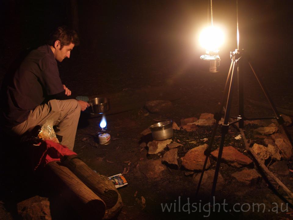
This is a basic metal structure with wooden bunks and an external water tank (check with the rangers to see if the tank has water in it) and can be booked at the park information centre for the princely fee of $5 per night. Alternatively, if the hut is already taken there is space to erect several tents in the surrounding forest. In late afternoon a short scramble up the rock outcrops behind the campsite provides fantastic views of the Grand High Tops.

Day 2: Balor Hut to Camp Pincham (11.8km 5 hours)
Day two begins with a return to the staircase used the night before and a thigh-straining climb up the stairs, which are soon replaced by an equally exhausting but slightly more natural-feeling steep dirt track, both of which are directly underneath the cliffs of the Breadknife. The outcrop is the remains of a volcanic feature known as a dyke, where molten rock squeezed through a vertical crack in the surrounding rock and then solidified, and it is very impressive – if a little disquieting – to think that the mass of rock to your right is only a couple of metres thick.
The track eventually leaves the Breadknife, passing another smaller dyke called Lughs Shield before eventually emerging on top of the range at Lughs Throne. This point lies at the centre of the Grand High Tops, and it is easy to see how the area got its name. To the east and north are Belougery Spire and the Breadknife, while to the south the scenery is dominated by the 1094m pillar of Crater Bluff and its distant companion Tonduran Spire.

From Lughs Throne the track crosses a number of rock slabs and then descends through forest to Dagda Saddle, where there is a junction with a second track between Balor Hut and the ridgetop. Ignore this, continuing along the range for a further 1.2km to Nuada Gap and the turnoff to Bluff Mountain. The 2.6km side trip to Bluff Mountain is well worth the effort, so drop packs and follow it uphill through eucalypt forest and extensive groves of grass trees, slowly contouring back and forth up the eastern slope of the peak to the summit plateau. At this point the forest opens up into heathland, providing grandstand views of the entire park. Be careful on the final stage to the summit cairn as the surrounding cliffs are over 200m high. After taking a well-deserved break on the mountain summit (which makes a great lunch spot) return to your packs and continue along the crest of the range. This area is known as Dows High Tops and is lower and less open than the Grand High Tops, but there are still a number of places where you can see good views, especially of the cliffs of Bluff Mountain to the left and ahead to the peak of Mount Exmouth, which at 1296m is the highest in the park.
The track undulates gently up and down for about half an hour then descends precipitously into Ogma Saddle. This is an excellent campsite, which can be used if you intend to spend an extra day taking the 6.3km return side trip to Mount Exmouth. Be warned though that there is no water here or anywhere else on the range except for Balor Hut.
From Ogma Saddle follow the track down the valley of West Spirey Creek for 3km before meeting the Spirey Creek track after crossing a large footbridge. The final 1.1km back to the car park can be enlivened by searching the tree tops for koalas, which are known to inhabit the creek valley.
NEED TO KNOW
The Warrumbungles lie between the mild climates of coastal Australia and the harsh desert interior, and the summer months between November and March are too hot for walking. Rainfall is also extremely unreliable, so ensure you check with the rangers before heading out to determine if there is anywhere on the walk where you can replenish you water supply. The closest town is Coonabarabran, 35km from the national park on the Newell Highway, the main artery between Brisbane and Melbourne. It will take one full day’s drive from the former and two from the latter to reach the park. From Sydney take the Great Western Highway to Dubbo and then follow the Newell Highway north. Buses can also be taken along the Newell but there is no public transport between Coonabarabran and the start of the walk. This is a multi-day walk and you will need appropriate equipment and supplies; make sure you check with the rangers that you have everything you need before you head out.

OTHER THINGS TO SEE AND DO
The Warrumbungles is a great spot to camp and spot wildlife – kangaroos are especially numerous – but there are not a lot of short walks. Whitegum Lookout is an easy stroll from the road and Belougery Split Rock will get the blood pumping over 3.6km, but most of the other trails lead up on to the high tops. The Siding Springs Observatory, located just outside the national park, is well worth a visit. A small visitor centre and café provide information about astronomy, but the star of the show is the Anglo-Australian Telescope, which is 15m long, weighs 260 tonnes and is housed in a 37m diameter dome that is visible from some parts of the Grand High Tops. It’s also worthwhile checking out the view from the walkway around the observatory. If you are looking for something more down to earth, Mount Kaputar National Park, 180km to the north of the Warrumbungles, features more volcanic landscapes formed at the same time as the peaks of the Grand High Tops.

ACCOMMODATION AND SUPPLIES
Car camping is available at several sites in the national park, while Coonabarabran has a full range of accommodation including motels and caravan parks. There are supermarkets in town that provide general supplies, but for more specific camping gear and hiking food you will need to visit Dubbo or take it in from Melbourne, Brisbane or Sydney. The visitor centre in the national park has a small food section selling soft drink and snacks.

MORE INFORMATION
Check the NSW National Parks web page on Warrumbungle National Park, or chat to the staff at the Warrumbungle National Park Visitor Information Centre for provide information on the park and process camping bookings – you should also visit the centre before you walk to check in and purchase a topographic map. They can be contacted on (02) 6825 4364.

These descriptions are a guide only. While we have made every effort to make them accurate, we accept no responsibility for any loss, injury or inconvenience sustained while using them. Make sure you use an up-to-date map and consult rangers before heading out.