5-8 DAYS, 63km
Widely regarded as the best walk in Australia and one of the best in the world, the Overland Track traverses the finest of Tasmania’s wilderness: rugged mountain peaks, wild alpine moors and deep forests. The distance from Ronny Creek, below Cradle Mountain, to Narcissus Hut, at the northern end of Lake St Clair, is 63km. But the beauty of the Overland Track is that no two trips are the same: create your own itinerary using the huts along the route and any combination of the numerous side trips to mountain peaks, lakes, waterfalls and beauty spots that diverge from the main path. Here’s a basic run-down. For information on on other things to see in this amazing area, check out our page on day walks in Cradle Mountain – Lake St Clair National Park.
Day 1: Cradle Valley to Waterfall Valley (10km, 5 hours)
or Cradle Valley to Scott Kilvert Hut (10.5km, 5 hours)
The main track climbs steeply from Ronny Creek to Marions Lookout for a grandstand view, continuing to Kitchen Hut, a tiny emergency shelter. From here you can take a side trip to the summit of Cradle Mountain (allow 1-2 hours – see here for detailed track notes) before continuing south.
The Overland Track passes behind the bulk of Cradle Mountain before descending into Waterfall Valley, but with a new Waterfall Valley Hut under construction walkers are encouraged to stay at Scott Kilvert Memorial Hut instead. There are two options to reach it from Kitchen Hut. If you have time, the more scenic route is via the face track across the north (front) of the mountain to reach a junction about 1.5km from Kitchen Hut.
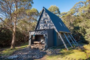
Turn right here onto the Lake Rodway Track and descend steeply on a 2km trail that passes Artists Pool, a beautiful tarn flanked by ancient pencil pines, Flynns Tarn and the lake after which the track is named before arriving at the hut, built in memory of teacher Ewen Scott and student David Kilvert, who died when a school group was caught in a blizzard near here in 1965. The other way to reach the hut is continue from Kitchen Hut on the Overland Track under the western flank of Cradle Mountain, turning left at a junction with a track that descends through forest to the reach the hut from the south. This last section takes about 30 to 45 minutes.
Day 2: Scott Kilvert Hut to Lake Windermere (7km, 2 hours)
From the A-frame hut the track continues south, climbing through forest for 1km to rejoin the Overland Track just south of Benson Peak. Turn left to walk south along the edge of Cradle Cirque. After 700 metres there is another junction, the starting point for a side trip to Barn Bluff (see notes below).
The main track descends to reach Waterfall Valley hut after another 1.7km. If you have time – or if the weather isn’t suitable for the Barn Bluff excursion – then spending an hour or so to explore Waterfall Valley is highly recommended.
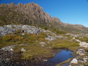
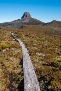
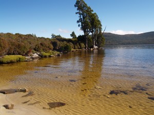
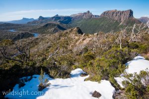
From Waterfall Valley the track climbs gently out of the valley before crossing an exposed moor then climbing to a ridge for a view of all the track’s major peaks – on a clear day – with Lake Windermere in the foreground. The hut is in attractive forest near the lake edge.
Side trip: Barn Bluff (6km, 2.5 hours)
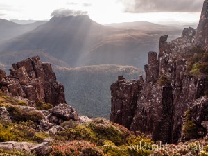
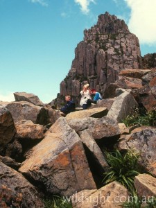
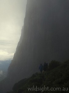
If you have time, and the weather is clear, the walk to Barn Bluff is one of the most enjoyable in this outstanding area. The path strikes out across the cirque, making easy walking for 1.5km before hitting a boulder field. Follow rock cairns across the boulders and up the steep dolerite cliffs. The views from the top are sensational. Return to the Overland Track via the same route.
Side-trip: Lake Will (2.6km, 1 hour return)
An easy side-trip 3.4km south of Waterfall Valley hut leads across an open moor to the eastern shore of the picturesque Lake Will.
Day 3: Windermere Hut to Pelion Hut (14km, 5.5 hours)
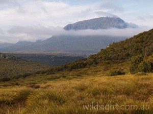
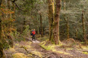
The track crosses Pine Forest Moor, an open buttongrass plain in the shadow of the massive Mt Pelion West, then enters dense forest where deep mud and tangled tree troots slow progress.
The path emerges in a clearing at Frog Flats, the lowest point of the track (720m). Avoid the leeches and climb to Pelion Plains and the New Pelion Hut, the most luxurious shelter on the track.
Side-trip: Mount Oakleigh (9.6km, 4 hours return)
From Pelion Hut follow the Arm River Track north for 400 metres, turning off after crossing Douglas Creek on a suspension bridge. Continue across the buttongrass plains and enter lovely rainforest on a track that climbs steeper and steeper, clambering up some rocky gullies to reach the summit plateau. Continue west for 1.3km to a rocky viewpoint above a set of gigantic dolerite spires, looking down across the Pelion Plains to all the major peaks of the track. Take care retracing the same route down and back to the hut.
Day 4: Pelion Hut to Kia Ora Hut (8km, 3 hours)
Climb through ancient rainforest to Pelion Gap, gaining 280m in about 2km. On a clear day the side-trip from here to Mount Ossa, Tasmania’s highest peak, is a must; the track is steep but the views are unforgettable. From the gap the track descends to Kia Ora Hut, located in eucalypt forest beside Kia Ora Creek. Kia Ora Falls are a short walk downstream.
Side trip: Mount Ossa (5km, 3 hours return)
The track climbs steadily west from the sign-posted junction, passing over Mount Doris then dropping to a saddle before embarking on the serious climb to the top of Mount Ossa. The path passes through scree then climbs steeply up a wide gully then over large boulders to reach the summit plateau for unforgettable 360-degree views. If you’re looking for a shorter challenge, the track to Mount Pelion East (2.4km, 2 hours return) also starts at Pelion Gap, heading in the opposite direction.
Day 5: Kia Ora Hut to Windy Ridge Hut (9km, 3 hours)
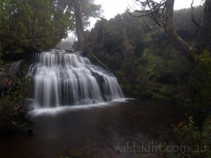
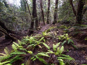
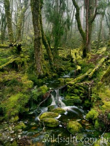
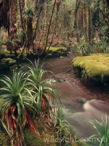
Thirty minutes of easy walking leads to historic Du Cane Hut. The hut, built in 1908, is now an emergency shelter only. The track then heads into magical forest of moss-covered myrtle beech trees to reach a junction, where tracks lead to nearby waterfalls. The main path continues through rainforest then climbs to Du Cane Gap 1070m, the last major climb of the track. A descent through more rainforest leads to Windy Ridge Hut.
Side-trip: D’Alton and Fergusson Falls (1km, 1 hour return)
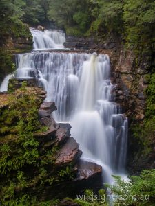
Follow a well-marked track through the forest for 600 metres to reach a T-intersection. The track to the right leads to Fergusson Falls, to the left D’Alton Falls is a five-minute walk away. These falls are best viewed from a ledge opposite the main drop. Return to the Overland Track via the same path.
Side-trip: Hartnett Falls (1.6km, 1 hour return)
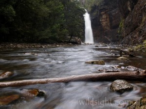
The track descends gently through forest to the top of the falls. Follow the track downstream to descend to the river 200 metres from the falls, it’s possible to walk back to the gorge at the base of the falls.
Day 6: Windy Ridge Hut to Pine Valley Hut (10km, 3.5 hours)
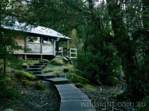
Pine Valley is technically not part of the Overland Track, but the beautiful setting and walking possibilities among the surrounding mountains demand inclusion in the itinerary if you have time. From Windy Ridge, 5km of easy walking brings you to the junction of the Pine Valley track. Turn right and cross several creeks on the way to Pine Valley Hut, set in beautiful rainforest beside Cephissus Creek. There are several tent platforms in the forest.
Day 7/8: Pine Valley
It’s recommended to stay for two more days in the valley two days to visit both the Labyrinth and the Acropolis.
Side-trip: The Acropolis (6km, 5 hours return)
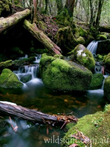
Follow the track north from the hut; after 40 metres a sign points the way to the Acropolis. The first section of the walk follows Cephissus Creek through stunning rainforest. Pause to admire the lovely cascades of Cephissus Falls then begin a long climb through the forest following markers on trees to eventually emerge on a plateau south of the bulk of the Acropolis.
Walk north to reach the bottom of the cliffs; the track winds its way up the eastern flank of the mountain before a final scramble to the top. This last section is very steep and exposed, in places you’ll need to find a good hand-hold – it is not recommended if the weather turns or the rock is icy. If you can make it safely to the top the highest point is 100 metres to the north – the top of a hair-raising rock spire. It’s not necessary to actually reach this point to admire the spectacular views. Take care on the descent before following the same track back to the hut.
Side-trip: The Labyrinth (6km, 4.5 hours return)
Follow the same track from the hut as described above to the junction after 40 metres, where a sign points the way to the Labyrinth, a plateau dotted with alpine lakes surrounded by wild mountains. The path winds through the rainforest before starting a long climb, follow markers on trees to the base of a small waterfall – the track is straight up the falls; fortunately the water flow usually doesn’t prove much of an obstacle, but your boots will get wet.
Above the falls the forest becomes drier and the climb steeper until it rounds the southern end of the Parthenon and levels out. Soon after views open up to the west then south across the plateau – encompassing a series of alpine lakes and all of Mount Gould, Walled Mountain, the imposing Mount Geryon and the Acropolis – before the track drops steeply to the edge of Cyane Lake. From the eastern side of the lake a path climbs to the Labyrinth Lookout for more outstanding views.
This is the suggested turn-around point but it’s possible to continue for another 1km to the shore of Lake Elysia – reflections in the lake are very popular among nature photographers. Make sure you allow time to return to the hut via the same track.
CLICK HERE FOR MORE DETAILED TRACK NOTES FOR THE LABYRINTH
Day 9: Pine Valley to Cynthia Bay (22km, 3.5 hours)
Return to the junction of the main track and turn right to reach Narcissus Hut at the northern end of Lake St Clair via a mostly flat track through forest and across buttongrass plains on an elevated boardwalk. From here it is possible to walk around the lake edge (17km) or take the easy option and use the radio in the hut to book a spot on the next boat across the lake.
NEED TO KNOW
It is compulsory to walk from north to south during peak season (October 1-May 31) and limited numbers are allowed on the track – book with the National Parks Service to ensure a spot. Booking fees for the 2019-2020 season were adults $200, children under 17 and concession card holders $160. This area is often completely under snow in winter and bad weather (including blizzards) can occur at any time of year, so be prepared. While this is one of the most travelled multi-day walks in Australia, it is still wilderness and should be treated with respect. A lot of work has been done in recent years to improve the condition of the track but it is still poor in some sections – expect to get muddy feet. Tasmap’s 1:100,000 Cradle Mountain-Lake St Clair map covers the entire track.
OTHER THINGS TO SEE AND DO
Base yourself at either end of the track – Cradle Valley or Lake St Clair – for some first-rate day walks, sightseeing and wildlife-spotting. Track notes for a selection of great day walks can be found here. Also check out descriptions of shorter overnight trips at either end of the track – Cradle Mountain circuit and the Labyrinth. Lake St Clair is also a popular fly fishing destination.
ACCOMMODATION AND SUPPLIES
Overnight stops along the track are at the excellent huts – Waterfall Valley, Windermere, Pelion, Kia Ora and usually one of Pine Valley, Narcissus or Echo Point, on the shore of Lake St Clair. The huts vary in size and provide shelter, a stove and wooden bunk beds, but you will need to bring a mattress, sleeping bag and fuel stove for cooking. It is also strongly advisable to carry a tent as space in the huts can’t be guaranteed. There is a campground and five-star accommodation at Cradle Mountain Lodge. The lodge has a small shop but stock up on walking equipment (and food) before you arrive.
Private operator Tassie Road Trips can pick up or drop off hikers at either end of the track.
MORE INFORMATION
For track bookings call (03) 6233 6047. The Cradle Mountain national parks visitor centre number is (03) 6492 1110.
