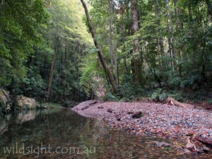
A drive along the Waterfall Way – a stretch of highway that winds 191km from Coffs Harbour on the northern NSW coast to the inland town of Armidale – can include visits to up to six outstanding national parks which collectively (along with several other nearby reserves) form the Gondwana Rainforests of Australia World Heritage Area.
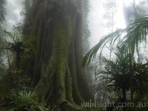
The two key reserves, at least in terms of walking, are Dorrigo and New England National Parks. Standing in the dark, silent forest makes you feel part of something very, very old – almost primeval. There’s a good reason for that; these forests contain plants and animals with direct links to the ancient supercontinent of Gondwana that broke up about 180 million years ago. The parks sit on the edge of the Great Escarpment, a line of rugged cliffs created about 19 million years ago by lava flows from the Ebor Volcano.
The first human inhabitants of the area were the Gumbaynggirr people, who called the area home centuries before the area was opened up to European settlers by timber cutters and dairy farmers. Fortunately for lovers of wild places, the terrain was too severe for all but the most hardy cows. Today much of the rainforest remains inaccessible, with walking tracks providing a taste of the immense beauty of the area.
Wonga Walk (6.6km, 2.5 hours)
Start/Finish: Dorrigo Rainforest Centre
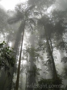
This is the main attraction at Dorrigo which means there are often crowds (especially around the visitor centre) and the track is possibly over-developed – much of it is bitumen. But the tree-top boardwalks are excellent and the forest is simply outstanding. And if you come early or late you can still get large sections to yourself (watch for cloud floating on the hills early in the morning – walking in the misty jungle is an unforgettable experience).
Starting at the Rainforest Centre, take the Lyrebird Link track to connect with the Wonga Walk – head right to complete the circuit anti-clockwise. After about 1km, take the short detour updwards on the “walk with the birds boardwalk” which ends just short of the Glade picnic area. There’s a barbeque and picnic shelter if you want to return later. From here, the track heads steadily downhill to a pair of waterfalls.
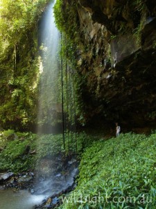
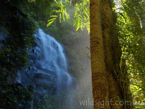
Crystal Shower Falls drops in a thin veil over a rock overhang covered in deep green epiphytes. The track passes behind the falls then loops around and crosses a creek below Tristiana Falls, which tumble down a black cliff. Then it’s a long steady climb back to the walk start. Don’t forget to turn right at the Lyrebird Link to return to the visitor centre.
Rosewood Creek circuit (7.7km, 3.5 hours)
Start/Finish: Never Never Picnic Area
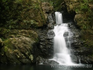
The Never Never picnic area is a short drive from the rainforest centre but feels a lot further – the crowds are left behind and the terrain, and tracks, are much rougher. This circuit combines several short tracks and takes in some wonderful forest scenery. From the picnic area the track heads north then swings south to descend above Rosewood Creek to Coachwood Falls, which thunder into a rocky gorge. Take care climbing down from the main track to a series of large flat rocks which provide an excellent vantage point.
Return to the track and continue south then west to reach a turnoff to Red Cedar Falls on the left. It’s a very steep descent to the highest falls in the park accessible by walking track. Giant red cedar trees are also a feature. After the steep climb back up to the main path, turn left . The next stop on the walk is Casuarina Falls. To get there turn left when the track reaches a T-intersection then left again on to the Blackbutt Track to descend to the falls.
Casuarina Falls plunge off a cliff, and just above the main drop is a small cascade surrounded by forest so lush it would hardly surprise if a small dinosaur emerged from the undergrowth. Views of the Rosewood River Valley from the top of the falls are outstanding, but stay away from the cliff edge. The track continues past the falls, but to complete the circuit you need to turn around here, following the Blackbutt Track back to the car park (ignoring the link track on the right).
Callicoma Falls (3.5km, 1.5 hours)
Start/Finish: Road to Never Never Picnic Area
This is an easy walk through attractive forest to a waterfall where Endiandra Creek drops into a small gorge. It also covers off all the tracks in Dorrigo, except for the section of the Blackbutt Track linking Callicoma Falls and Casuarina Falls. Continuing all the way to the falls makes for a 6km return trip. The track starts at a car park between the rainforest centre and Never Never Picnic Area just inside the park boundary.
Point Lookout (500m. 20 minutes)
Start/Finish: Point Lookout Car Park
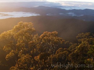
An easy walk starts near the picnic shelter and leads through snowgums to the lookout perched on the edge of the Great Escarpment, more than 1500 metres above sea level and hundreds of metres above the forests below. The views are incredible, with range after range all the way to the Pacific Ocean. A magical spot to watch the sun rise – but wear gloves!
Eagles Nest-Five Day Creek (11km, 6-7 hours)
Start/Finish: Berarngutta Picnic Area
This is a full-day circuit that links several tracks in New England National Park to create one of the best day walks in Australia. The starting point is Berarngutta Picnic Area, 1km from Point Lookout on the left-hand side of the road. The track leaves the picnic area and heads north along the cliff-line. A path joins from the left, these are steps from Point Lookout (if you haven’t visited the lookout a quick detour may be in order). Turn left at the next junction to descend quickly on the Eagles Nest track.
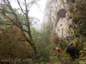
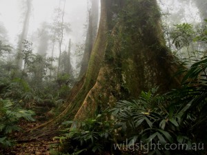
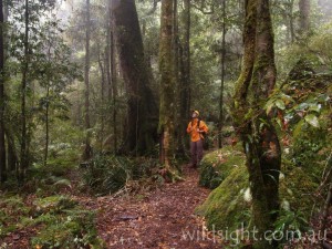
The next couple of kilometers is simply stunning walking. This is serious jungle – dense, dark forest that feels like it hasn’t changed in millions of years – which makes sense because it hasn’t. Eagles Nest Lookout provides views through the mist and at Weeping Rock water drips down the cliffs, forming icicles in winter. Soon after passing Weeping Rock ignore a side-track and continue on the Lyrebird Track which leads south-east through the forest, with cliffs rising to the right just visible through the trees.
About 2.5km from Weeping Rock the track suddenly swings to the right at a junction. Take the track to the left and cross Robinsons Knob Trail to pick up the track on the other side. You immediately arrive at another junction – take the detour to Wright’s Lookout, a 750-metre scramble to a perch high over the Bellinger and Macleay River valleys. Take care near the edge, there is no fence and it’s a serious drop.
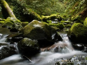
Return to the main trail and turn left. After 200 metres a sign indicates the Cascades Walk loop. Head right and descend to the stunning Five Day Creek, which flows over and between giant boulders and fallen tree trunks covered in lush green moss while rainforest trees hug the banks. The track follows the creek bank for about 1km – take care, it can be very slippery – then climbs back to the loop start.
Continue back past the Wrights Lookout turnoff and cross Robinsons Knob Trail. When the track rejoins the Lyrebird Walk on the other side turn left. The track leads along the roadside for 250 metres then turns sharply right to head back towards Point Lookout. The track follows the top of the cliffs for 2km to Banksia Point Picnic Area and Platypus Lookout another 500 metres further on. From the lookout the track swings south again – ignore the side-track to Point Lookout and continue through eucalypt forest to cross Point Lookout Road. Berarngutta Picnic Area is on the other side of the road.
Dangar Falls (1.5km, 30 minutes)
Start/Finish: Playground beside Coramba Road
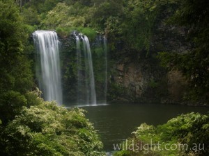
A yellow sign 2km north of the Dorrigo township marks the start of the track to the falls. The track drops steeply to the riverbank then follows a wooden boardwalk to a lookout platform which offers excellent views of the falls, which plunge 30 metres over a basalt wall into the Bielsdown River. Follow the same track back to the playground.
Ebor Falls (2km, 30 minutes)
Start/Finish: Ebor Falls car park
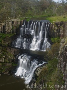
Ebor Falls is clearly signposted from the Waterfall Way east of Point Lookout in Guy Fawkes National Park. A lookout close to the car park provides an excellent view of the upper drop of Ebor Falls as it cascades 100 metres over two main tiers. A short walk downstream along a sealed path leads to another large drop which is equally spectacular although the view is slightly more distant. Retrace your steps to the car park.
OTHER THINGS TO SEE AND DO
Any visit to Dorrigo is incomplete without a visit to the national park visitor information centre, the star attraction of which is a canopy walkway which gives you the chance to see the rainforest from the point of view of the animals that live in the treetops. It’s also a great place to chat to a ranger or buy some souvenirs. We also recommend spending some time in the picturesque town of Dorrigo itself.
If you haven’t had your fill of rainforest there is still plenty to see – the Gondwana Rainforests of Australia World Heritage Area contains 18 national parks including 11 in New South Wales, most of which are within a few hours drive of Dorrigo.
FLORA AND FAUNA
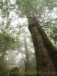
The headline act here is rainforest and there are four different kinds to explore – subtropical, warm temperate, cool temperate and dry rainforest. Rare Antarctic Beech trees, some of which are over 5000 years old, are found on the Eagles Nest walk in New England and along Rosewood River in Dorrigo. If you need more variety snowgums grow near Point Lookout and there are areas of eucalypt forest and heathland. But if you don’t like rainforest, you’re in the wrong place!
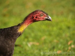
The forests are a mecca for birdwatchers; Dorrigo National Park alone is home to 128 species of birds – look for regent bowerbirds, king parrots, paradise riflebirds and powerful owls for starters. You won’t need binoculars to spot brush turkeys, which regularly stroll across walking paths.
Swamp wallabies are common as are red-necked pademelons, which are often seen grazing in picnic areas late in the day. Other forest inhabitants include gliders, potoroos, bandicoots and possums, although you are unlikely to see them during daylight hours. Local reptiles include carpet pythons and the rare southern angle-headed dragon, which clings motionless to tree trunks to blend in with the rainforest surroundings.
ACCESS
Dorrigo and New England National Parks are both accessed via the Waterfall Way. The town of Dorrigo is about 40km from the coast – turn onto the Waterfall Way at Raleigh. Take Dome Rd 2km east of town which leads to the Dorrigo Rainforest Centre. To find New England take the turnoff to Point Lookout 85km east of Armidale.
WEATHER
It’s rainforest, so expect to get wet. The highest rainfall months are January, February and March. It can get hot here too – the highest recorded temperature is 43 degrees – but snow is most definitely not unknown. So be prepared for anything.
CAMPING AND ACCOMMODATION
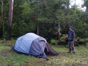
The Thungutti campground in New England has 18 tent sites and a camp kitchen with gas/electric barbeques plus fresh water and pit toilets. The campground is 4km from the end of Point Lookout Road. Sites are available on a first-come, first-served basis. There are no established campgrounds in Dorrigo but the town of Dorrigo specializes in bed and breakfasts. For hostel-style accommodation try Dangars Lodge (02 6657 2131) which can sleep up to 12 people and is just over the road from Dangars Falls. For more information visit: http://www.dorrigo.com/accommodation.html
SAFETY/WARNINGS
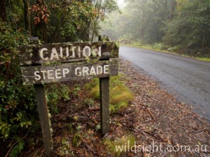
The rainforests are generally a safe place to visit, but take the usual precautions when entering any wild area. Tracks can be slippery after rain – take care around rivers and cliff edges – and make sure you let someone know where you’re going and when you expect to return.
TRACKS
The vast majority of both New England and Dorrigo National Parks is trackless, the few walking routes available are described above. The tracks are in generally good condition but can become muddy after rain – which is often.
MORE INFORMATION
The Dorrigo visitor centre can be reached on (02) 6657 2309
These descriptions are a guide only. While we have made every effort to make them accurate, we accept no responsibility for any loss, injury or inconvenience sustained while using them. Make sure you use an up-to-date map and consult rangers before heading out.
