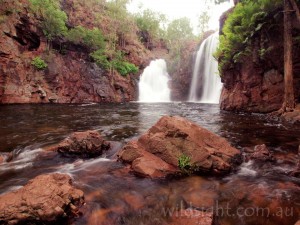
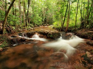
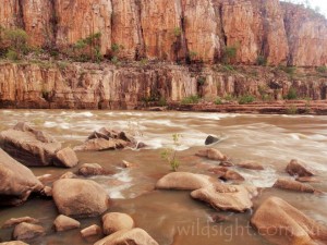
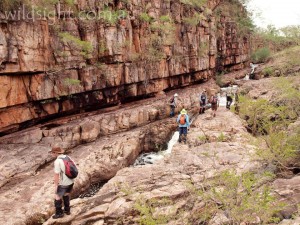
Australia’s tropical north is like nowhere else on Earth. Extraordinarily diverse and beautiful landscapes ranging from rugged cliffs to colourful wetlands support a huge array of plants and animals, many of them found only here.
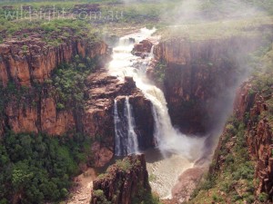
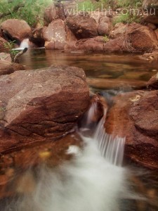
Kakadu National Park is the jewel in the crown; at almost 20,000 square kilometres it is the size of a small country. Kakadu preserves the greatest variety of ecosystems on the Australian continent and is inscribed on the World Heritage List for its outstanding natural and cultural values. And Kakadu isn’t the only place in the Top End to showcase the wild signatures of this amazing part of Australia. The nearby (on a Northern Territory scale) national parks of Litchfield and Nitmiluk (Katherine Gorge) feature deep gorges, jaw-dropping waterfalls and wild rivers that swell with the annual wet season rain.
This is a living landscape. Humans have inhabited Kakadu for more than 50,000 years and have recorded their connection with the land in the form of rock art for more than 20,000 years. There are at least 5000 rock art sites in Kakadu. There might be 15,000. This connection continues today and is an integral part of what makes this a must-see destination.
Note: This is a small selection of walks available in a gigantic area and is based on a wet season visit when many of the longer tracks are closed. See local rangers for more options
KAKADU WALKS
Ubirr (2km,1 hour)
Start/finish: Ubirr car park
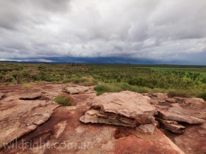
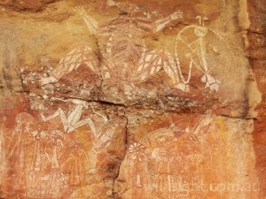
An excellent short walk that packs the best of Kakadu into a small area. From the car park turn right to follow the 1km wheelchair-accessible circuit anti-clockwise. Visit the Mabuyu and main art galleries, two spectacular rock art sites – look for the European figure with his hands in his pockets and a thylacine (Tasmanian Tiger), evidence of a species which died out on the Australian mainland about 2000 years ago. Leave the circuit to climb a rocky slope, passing more rock art en route to Nadab lookout which offers outstanding views over the Kakadu floodplain. This is a very popular sunset spot in the drier months of the year. Retrace your steps to rejoin the circuit – turn right to return to the car park via more rock art featuring depictions of the Rainbow Serpent.
Nourlangie rock art site (1.5km, 45 minutes)
Start/finish: Nourlangie car park
Another loop walk – stay right on the wheelchair-accessible track, leaving the main path to visit Gunwarddehwarde Lookout for views across the treetops to the Arnhem Land escarpment. Return to the track and head right to return via a series of excellent rock art sites, starting with a depiction of Namarrgon, the lightning man who in traditional Aboriginal belief uses his stone axes to split the clouds and create the wet season thunderstorms. The track visits two more shelters before returning to the main track near the car park. In the dry season visit Anbangbang Billabong nearby – this is totally cut off in the wet.
Barrk walk (12km, 6 hours)
Start/finish: Nourlangie car park
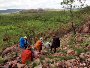
A great longer walk through rugged sandstone country around Nourlangie Rock. Follow the main Nourlangie path to Gunwarddehwarde Lookout as described above, then follow the signs to continue up a rocky valley that features a patch of monsoon forest. Climb over a saddle and continue north through heathland into stone country, passing between boulders and sandstone pillars. The track traverses rock slabs then loops to the west and descends steeply to the valley floor. Walking from here back to the walk start is through open woodland and tall spear grass in the wet season – take a short detour to visit Nanguluwur gallery which features images of people, animals, spirits and a sailing ship.
Motor Car Falls (7.5km, 4 hours)
Start/finish: Yurmikmik car park
One of several excellent walks in the southern hills and ridges of Kakadu that is accessible during the wet season (but beware of flash flooding). Turn off the Kakadu Highway at the ranger station 59km from Pine Creek and follow the gravel road to a marked car park. A wide track is easy to follow through open woodland, passing many termite mounds. There is a junction marked by an emergency satellite phone – turn right here to enter lush monsoon forest, following track markers to a shady pool at the base of the falls which are especially impressive in the wet. Return via the same track.
Gunlom Falls (1.5km, 1 hour)
Start/finish: Gunlom car park
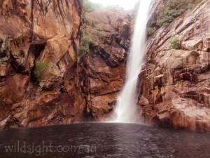
To reach Gunlom (Waterfall Creek) continue past Yurmikmik and turn left after crossing the South Alligator River; the car park is 37km from the highway. It can only be reached in the dry season as rising water makes the South Alligator River impassible in the wet. It is just 200m from the car park to the beautiful pool at the base of Gunlom with its stunning infinity edge. A tougher 1km return track leads through rough rocky country to the top of the falls.
LITCHFIELD WALKS
Tolmer Falls (2km, 1 hour)
Start/finish: Tolmer Falls car park
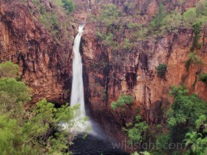
Tolmer Falls in Litchfield National Park is one of the most spectacular in the Top End, with the creek tumbling over sheer cliffs into a plunge pool far below. Follow a bitumen path for 400 metres to a viewing platform directly opposite the falls. From here a rougher track can be followed to return the car park through sandstone country along Tolmer Creek, passing a series of beautiful rockpools.
Florence Falls and Shady Creek (1.5km, 45 minutes)
Start/finish: Florence Falls car park
Another bitumen track leads to a viewing platform that looks down over the twin cascades of Florence Falls.
Descend 160 stairs to the plunge pool – bring your swimming gear and a towel. To avoid the climb back up the stairs, and to see another beautiful part of Litchfield, return via the Shady Creek walk which follows the creek through rainforest, crossing it several times before climbing back to the car park.
NITMILUK WALKS
Baruwei loop walk (4.8km, 2 hours)
Start/finish: Nitmiluk visitor centre
From the back of the visitor centre walk about 300 metres to the Katherine River, the starting point for boat tours up the gorge. Continue past the boat ramp and a toilet block to climb to a lookout with views over the start of the gorge. Handrails assist in the steepest sections. Take the longer return route along the top of the cliffs before a steep descent to return to the visitor centre.
Butterfly Gorge (12km, 4.5 hours)
Start/finish: Nitmiluk visitor centre
A longer walk to a beautiful shaded gorge that joins the main Katherine Gorge. Follow the Baruwei walk to a junction just before the final descent off the escarpment. From here it’s just over 2km to Butterfly Gorge, which gets its name from a large butterfly population. You can extend the trip further by continuing to the Lily Ponds, but this adds another 11km so give yourself plenty of time and carry lots of water. Both are excellent and safe swimming spots.
Leliyn trail (2.6km, 2 hours)
Start/finish: Edith Falls camping area
This section of Nitmiluk offers picturesque waterholes, waterfalls and excellent swimming spots. A sign on the Stuart Highway 40km north of Katherine marks the turnoff to Edith Falls – it’s 20km on a sealed road to the car park, and only 100m or so from here to the large pool at the base of the falls, which are more of a cascade on the far side of the pool. Cross the creek and climb the slope to Bemang Lookout before dropping to cross the creek above the falls and just below Upper Pool, a beautiful swimming spot and the site of more waterfalls that are more impressive than the main Edith Falls. To complete the circuit walk, cross the creek and climb to another lookout on the other side. Pass a turnoff to Sweetwater Pool (an 8.6km return walk if you have time) then return to the camping area.
OTHER THINGS TO SEE AND DO
You’ll see some amazing sights from walking tracks but to explore deeper into the park other modes of transport are required.
The Yellow Waters cruise in Kakadu is a don’t-miss experience, with the sunrise departure highly recommended. Expect to see crocodiles and a lot of birds. In Nitmiluk a boat cruise is a great way to see Katherine Gorge from the river.
Scenic flights unlock vast areas of the Top End that are inaccessible any other way; flying in a helicopter bumps up the price but you’ll get a lot closer to the amazing waterfalls and cliffs of the Arnhem Land escarpment. If the water is pumping a low-altitude pass over Twin Falls and Jim Jim Falls is one of the highlights of a Top End trip.
Visitors centres at Kakadu and Nitmiluk provide information on other activities including excellent experiences run by the traditional owners.
ACCESS
Jabiru, Kadadu’s main tourist town, is 255km from Darwin via the Arnhem Highway. An alternative route is to travel south on the Stuart Highway to Pine Creek (about 225km) and enter the park from the south. This is the quickest way to access the Yurmikmik walks – but quicker is a relative term, allow half a day for the trip.
To reach Katherine head south to Pine Creek and keep going. The town is 316km from Darwin and Nitmiluk National Park is 30km from the town centre.
Litchfield is accessed via the town of Batchelor – turn off the Stuart Highway 90km south of Darwin. The park is about a 90-minute drive from the state capital.
SAFETY/WARNINGS
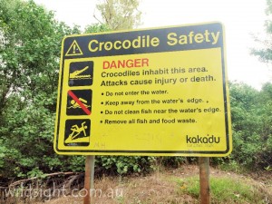
The two biggest dangers here are the weather and crocs. Cyclones are possible in summer and dangerous storms are part of the weather cycle; take extreme care when crossing waterways on foot or in a vehicle (often the best option is to not cross at all). In summer extreme heat can be just as dangerous – carry plenty of water and don’t stay out in the sun too long.
There are crocodile warning signs all over the park – obey them! Stay out of the water and away from the water’s edge. If you don’t see a sign, assume there are crocodiles around.
TRACKS
The popular tracks in Kakadu around Ubirr and Nourlangie are wheelchair-accessible, although you will need to leave the main track and cross some bare rock to reach the best vantage points. In more remote parts of the park tracks are a lot rougher if they exist at all – off-track navigation skills are essential. The same description applies to Litchfield and Nitmiluk.
ACCOMMODATION AND CAMPING
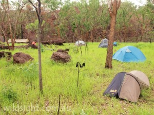
In Kakadu there are two tourist towns, Jabiru and Cooinda. The Mercure Crocodile Hotel (built in the shape of a crocodile) offers classy accommodation in Jabiru and there are more affordable lodges in both towns. There are numerous commercial and bush campgrounds throughout the park – contact the ranger office for more info.
In Nitmiluk there are permanent campgrounds at Katherine Gorge and Edith Falls and a number of remote bush campsites – see the rangers for details of locations and facilities. There is also a luxury eco-lodge right next to the park entrance.
In Litchfield camping is available at Wangi Falls, Buley Rockhole and Florence Falls. Four-wheel drive camping areas (dry season only) are located at Tjaynera Falls (Sandy Creek), Surprise Creek Falls and downstream from Florence Falls, and there are walk-in campsites along Walker Creek (dry season only). Accommodation and camping are available outside the park at several commercial sites including the Litchfield Safari Camp which offers accommodation in safari tents just outside the southern border of the park, 4km from Wangi Falls.
WEATHER
The Top End is commonly thought of as having two distinct seasons – the dry (April to October) and the wet (November to March). But the traditional owners speak of six seasons:
Yegge (May to mid-June) – cool with low humidity
Wurrgeng (mid-June to mid-August) – daytime temperatures of about 30C dropping to 17C at night. Most creeks stop flowing and the flood plains dry out.
Gurrung (mid-August to mid-October) – hot and dry. Wildlife concentrated around remaining water sources such as Yellow Waters billabong.
Gunumeleng (mid-October to late December) – pre-monsoon season. Hot (often over 40C in the daytime) and humid with large afternoon thunderstorms.
Gudjewg (late December to March) – monsoon season. Heavy rains and flooding. Floodplains fill up, wildlife disperses, waterfalls are at their epic best but many areas are difficult to access with roads cut off.
Banggerreng (April) – rain clouds disperse and floodwaters recede.
FLORA AND FAUNA
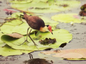
Kakadu supports an immense variety of plants and animals in six distinct ecoystems: coasts and tidal flats, stone country, savannah woodlands, monsoonal rainforest, wetlands and the southern hills. The park is home to more than 2000 plant species, 280 species of birds (one-third of Australia’s total), 68 different mammals, 10,000 types of insects and 120 reptiles including saltwater and freshwater crocodiles.
Salties are one of the icons of the park and live in all the lowland waterways. They have been responsible for a number of human deaths. Freshwater crocodiles are smaller and shyer and will usually only attack if provoked. Both species deserve our respect.
MORE INFORMATION
Litchfield – NT Parks and Wildlife page
Nitmiluk – NT Parks and Wildlife page
These descriptions are a guide only. While we have made every effort to make them accurate, we accept no responsibility for any loss, injury or inconvenience sustained while using them. Make sure you use an up-to-date map and consult rangers before heading out.
