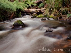
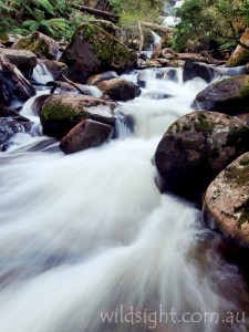
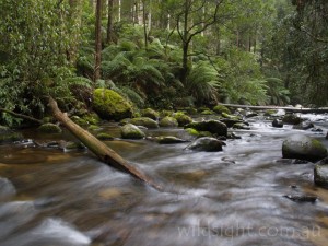
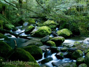
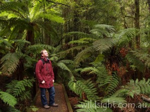
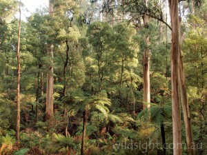
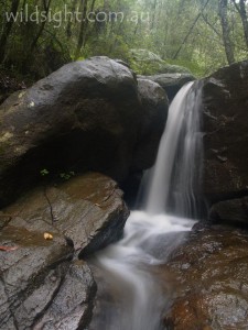
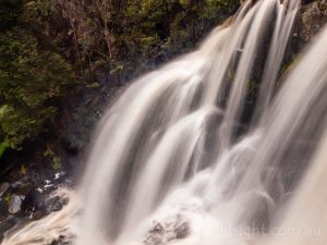
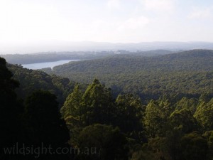
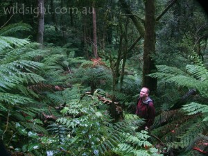
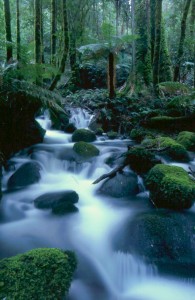
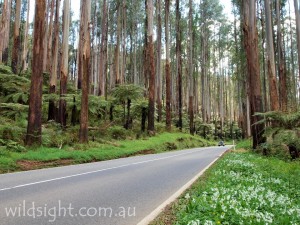
Lush rainforest, waterfalls, bubbling creeks and the some of the world’s tallest trees – all within a couple of hours’ drive from the centre of Melbourne. Ringing the city to the east and north are heavily forested mountains that make a fantastic escape from the city for a scenic drive, picnic or bushwalking expedition. The Dandenongs are close enough to be on the suburban rail line, and have been a favourite spot for Melbournians to take a quiet walk or enjoy a devonshire tea for generations. A bit further out the Yarra Ranges National Park protects majestic mountain ash forest, patches of cool temperate rainforest and clear mountain streams that give Melburnians some of the cleanest drinking water in the world. There is more great scenery in Kinglake National Park and nearby reserves including Marysville, Noojee and Toolangi Black Range State Forests. There is a push to unite the reserves in a Great Forest National Park to preserve them forever from logging to be enjoyed with quiet awe by future generations.
Cumberland Walk (4km, 2 hours)
Start/finish: Cambarville picnic area
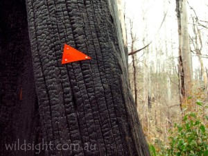
Head north-west to complete this leisurely loop anti-clockwise. The first notable feature is the Big Tree, a large mountain ash in a small clearing (it was bigger before the top was lopped off by lightning). The track turns south to cross the road at the Big Tree-Cora Lynn Falls car park. Pick up the track again and continue south, turning right at a junction to descend to the pretty Cora Lynn Cascades. Return to the main track and walk through forest burnt out in the 2009 fires to cross the Cumberland Creek on a wooden bridge above Cumberland Falls. The next section of track follows an old water race built by miners in the 1870s. The spot provides a view towards Warburton. From here it’s a short walk back to the picnic area.
Phantom Falls (1.6km, 45 minutes)
Start/finish: Phantom Falls car park
The Lady Talbot Forest Drive starts near Marysville and provides access to several excellent forest walks and waterfalls. The first car park is for Phantom Falls, and the walk starts with a climb from the Taggerty River to a gully choked with tree ferns, where the falls flow over steeply sloped rock. Views are partially obstructed by the surrounding vegetation. Return to the car park on the same path.
Keppell Falls (2km, 45 minutes)
Start/finish: Keppell Falls car park
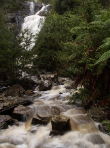
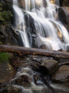
The next stop on the Lady Talbot Forest Drive is one of the most underrated waterfalls in the Yarra Ranges, and possibly Victoria. The wide path follows the Taggerty River to a wooden viewing platform for a great view of the falls tumbling over a short drop then rushing over boulders in the tree-fern lined river. Return to the car park on the same track. A short distance up the road is a lookout offering a long-distance view of the falls from above.
The Beeches forest walk (4km, 2 hours)
Start/finish: The Beeches picnic area, Lady Talbot Forest Drive
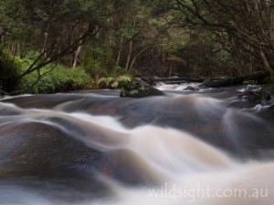
This excellent circuit can be started at either the Beeches or Taggerty Cascades car park – both are included in the route. And the walk can be done in either direction (note that the section of road from Keppell Falls to the Beeches is rough and is sometimes closed to two-wheel drive vehicles).From the car park the walking track winds through magical cool temperate rainforest with moss-covered myrtle beech and sassafras trees looming on both sides. The path follows the beautiful Taggerty River to Taggerty Cascades then on to the Meeting of the Waters where the river joins Whitehouse Creek. If you’re lucky (and quiet) you may spot a lyrebird in the forest or a shy antechinus in a tree hollow.
Cement Creek (350m, 20 minutes)
Start/finish: Cement Creek rainforest gallery
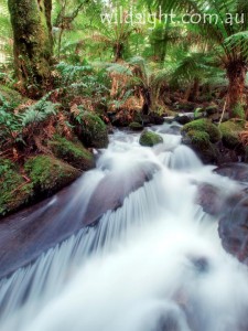
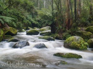
One of Melbourne’s unheralded gems. An old muddy track beside the creek has been replaced in recent years by a raised metal walkway through a beautiful stand of cool temperate rainforest on the slopes of Mount Donna Buang. The walkway includes views of the delightful creek as it bubbles over moss-coloured boulders. There is also a short walk to an observation platform that allows you to look down on the forest from among the canopy.
Steavenson Falls (700 metres, 20 minutes)
Start/finish: Falls car park, Steavenson Road
A well graded track close to Marysville leads to a viewing platform below the 84-metre falls, one of the highest in Victoria. Cross the creek on a bridge and continue to the main viewing area before returning via the same route. The falls are floodlit at night.
The Ada Tree (3.2km, 1.5 hours)
Start/Finish: Ada Tree Picnic Area
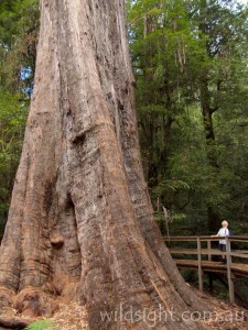
There are few better places in the world to see big trees than the Yarra Ranges, and quite possibly the most impressive of all is the Ada Tree. The 270-year-old behemoth is 76 metres high, with a circumference of 15 metres, and it towers over the surrounding rainforest. From the picnic area follow the track as it meanders through the rainforest to the tree, which is surrounded by a boardwalk. The Ada tree is a mountain ash (Eucalyptus regnans), the tallest flowering plant on Earth. Once the forest was full of giants like this but most of the others have been logged, leaving just a few to remind us of how impressive they once were. If you have time continue along the Little Ada River to the camping area at Federal Mill (add 1.4km each way) before returning via the same route to the picnic area.
Masons Falls circuit (3.5km, 4.5 hours)
Start/finish: Kinglake National Park information centre
Kinglake National Park protects a wide variety of native vegetation on Melbourne’s northern fringe and this walk includes the park’s two best-known features, Masons Falls and Mount Sugarloaf. The track starts at a road junction just inside the park entrance, walk south on the Sugarloaf Ridge track through messmate forest beside the road (crossing it once) to reach a junction after 2.1km. The path to the right, Running Creek Track, will be followed shortly but for now continue straight ahead to visit the 570-metre summit of Mount Sugarloaf, where views are blocked by trees – the Melbourne skyline can be seen from a lookout 100 metres past the summit. Return to the junction and turn left on to Running Creek Track. Cross the road and climb a ridge then descend into a fern gully known as the Tryst. The track follows Running Creek north, climbing gently for 2km past more delightful gullies at Hazel Glade and Ferny Nook. After Ferny Nook the track turns east and climbs to the large viewing platform to Masons Falls. The falls drop 45 metres and are spectacular after heavy rain, but dry up to a trickle for much of the year. Continue north for 500 metres to Masons Falls car park. Pick up Boundary Track on the other side of the car park. This track heads east then turns south to return to the starting point.
Murrinindi Cascades (600 metres, 30 minutes)
Start/finish: Cascades picnic area
The cascades, where the Murrinindi River tumbles over large granite boulders, are a highlight of Murrinindi Scenic Reserve, located at the southern end of Toolangi State Forest between Healesville and Kinglake. From the picnic area cross the road and follow the steps down to where two bridges cross the river at the base of the cascades. Return to the car park or follow the river for 12km on the Murrinindi River Walk. The track takes about three hours so it’s best to have a car waiting at the other end.
Wirrawilla Rainforest Walk (1km, 20 minutes)
Start/finish: Wirrawilla Rainforest Walk car park, Sylvia Creek Road
A boardwalk leads through a beautiful pocket of cool temperate rainforest in Toolangi State Forest that survived the Black Saturday bushfires. Wirrawilla means “green trees” in the local Aboriginal language and the track certainly lives up to its name as it follows the clear waters of Sylvia Creek. Keep an eye out for for platypus and lyrebirds.
Lake Mountain summit loop (4km, 1.5 hours)
Start/finish: Lake Mountain car park
It’s a 900-metre walk from the car park to the summit. There are no views from the top but just before the summit a side-track leads to a lookout over Marysville. Better views are 300 metres further on at the Alps Lookout. After walking through snowgums for another 800 metres the track reaches a junction. Turn right to return to the car park past another lookout at Taggerty Valley View.
La La Falls (3.2km, 1 hour)
Start/finish: Irruka Road
A nice short walk near Warburton to a small but picturesque waterfall. Drive south out of Warburton on Park Road and turn on to Old Warburton Road then Irruka Road.
Reids Tramline (6km, 2.5 hours)
Start/Finish: Powelltown
The walk starts at the picnic area opposite the Department of Sustainability and Environment office and winds through majestic forest, following the route of a tramline used by timber workers in the late 1800s and early 1900s – long before the days of clear-fell logging. Relics reclaimed by the forest in the decades since are a feature of the walk. The track ends at Reids Mill; return via the same route.
Toorongo and Amphitheatre Falls (2.2km, 1 hour)
Start/finish: Toorongo Falls day visitor area, Toorongo Valley Road
An excellent circuit that visits two waterfalls near the town of Noojee at the southern end of the Yarra Ranges. From the car park cross Toorongo River on a wooden bridge and head left when the track splits, following the river to a viewing platform, overlooking Amphitheatre Falls which tumble into a fern-filled gully. Turn around and head uphill to continue to Tooronga Falls. A wooden platform abuts the falls which crash over a small cliff into a log-filled pool. They are an impressive sight especially after heavy rain. Do a sharp right turn to follow the track through the forest back to the bridge.
Sherbrooke Forest (7km, 2.5 hours)
Start/finish: Grants Picnic Ground
There is a maze of tracks in the Dandenongs forests that can be combined to form short or long day walks – this route covers the best of Sherbrooke Forest but could be modified to suit time or fitness demands. From the picnic ground cross Monbulk Road and start walking at a small gate. Stay left to follow Treefern Track which crosses Clematis Creek on a wooden bridge then swings north to hit Lodge Road – walk on the roadside for about 800 metres to O’Donohue Picnic Ground. The track continues west; at a junction turn right following signs to Sherbrooke Falls, reached 1.1km from O’Donohue Picnic Ground.
Continue along Hillclimb Track which descends through wet forest to cross Sherbrooke Creek. Keep left at the next two track junctions to enter a car park beside Micawber Tavern. Cross the road with care and pick up the track on the other side – you want to be on Bleakeley Track to the left, ignore Lipscombe Track which leads straight ahead. Bleakeley Track heads north (left) through tall forest above the road for 2km back to Grants Picnic Ground.
Sherbrooke Falls (2.4km, 1 hour)
Start/finish: Sherbrooke picnic ground
The falls are more of a cascade than a true waterfall but the walk is a pleasant stroll through the mountain ash forest. From the picnic ground the path winds through the eucalypts and tree ferns on a gradual descent to the falls. Return on the same path.
Olinda Falls (7.2km, 2.5 hours)
Start/finish: Mechanics Reserve, Mount Dandenong Tourist Road
These have more of a claim to the title of waterfall, and the walking in this section of the park feels a bit wilder – and wetter; expect to encounter mud especially after rain, when the falls are at their best. Start at the signposted track opposite the Mount Dandenong Arboretum and head downhill, crossing Falls Road before the track splits to viewing platforms at the upper and lower falls – the lower section is more impressive. Return to the main track and head right to follow Cascade Track which follows the creek for 1.1km to Barbers Road. Turn right and follow the road for 200 metres then turn right again on to VW Track which climbs for 1km to meet Barges Track. Turn right here and follow the management vehicle track south for 300 metres – ignore side tracks on the left and continue to a gate where Bartlett Tack meets Falls Road. Turn right again and follow the public road north for 300 metres to the intersect Mehanics Track. Turn left and retrace the first 1.1km of the walk to complete the circuit.
Snobs Creek Falls (500 metres, 15 minutes)
Start/Finish: Snobs Creek car park
Another little known gem in the Rubicon State Forest near Eildon. The walk itself is very easy, with a track from the small car park following the picturesque creek until it tumbles over a set of boulders into the pool below – a viewing platform has been built about halfway down the falls to give a close-up view of the cascade which is particularly impressive after rain. The trick is getting there – from Eildon drive towards Alexandra on the Goulburn Valley Highway. After about 6km turn left onto Snobs Creek Road and continue for another 6km or so to a small parking area with room for a couple of cars. There is a sign pointing the way to the falls.
North and South Jawbone Peak (4.8km, 3 hours)
Start/Finish: Jawbone car park, Cerberus Road
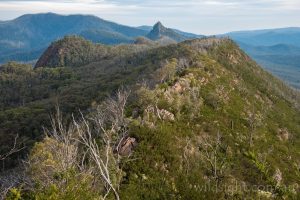
Cathedral Range State Park near Buxton is home to a rocky ridgeline which offers several impressive viewpoints and some fun, challenging walking. This day walk samples the best of the park, starting with a steep climb through eucalypt forest to the Farmyard, a large clearing that makes an excellent campsite if you’re planning to spend the night in the mountains. Tracks lead from here to the North and South Jawbones, two rocky outcrops the provide views over the trees along the range and over the surrounding farmland. Both tracks are rough and have steep sections. Take care returning to the Farmyard and back to the car.
OTHER THINGS TO SEE AND DO
The forest trails are a mecca for mountain bikers – try the 38km Warburton rail trail from Warburton to Mount Evelyn, or the 20km of tracks at Lysterfield Lake, the site of mountain bike events at the 2006 Commonwealth Games. Beginners can get a taste of caving at Brittania Creek near Warburton and in winter there is enough snow around to ride a taboggan down the higher reaches of Mount Donna Buang and try cross-country skiing at Lake Mountain. The towns and hamlets dotted throughout the ranges have a plethora of cafes, tea houses and antique shops that make a delightful day out and the Yarra Valley is home to some of Australia’s best wineries.
CAMPING AND ACCOMMODATION
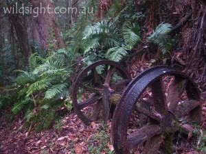
There are no campgrounds in Dandenongs or Yarra Ranges National Park but there are good options in adjacent parks, including Starlings Gap, Federal Mill and Ada No.2 Mill in Yarra State Forest – rusted timber-cutting relics provide an added attraction. There is a well-appointed campground at the Upper Yarra Reservoir Park and in the Dandenongs you can pitch a tent at Wombat Corner near Emerald Lake Park, at Kurth Kiln Park (the closest bush camping to Melbourne) and in Bunyip State Park. There are caravan parks and varioius levels of accommodation in towns across the region.
FLORA AND FAUNA
The park is home to the endangered Leadbeaters Possum, Victoria’s animal emblem, and the shy superb lyrebird. Large pristine tracts of mountain ash forests with an understory of tree ferns and gullies of cool temperate rainforest are of high ecological significance and provide important tree hollows that are home to bats, owls and gliders. Sub-alpine vegetation including snowgums grows on the highest peaks.
WEATHER
Temperatures are usually 3-4 degrees cooler than in Melbourne and the Yarra Ranges is one of the wettest places in Victoria, with Warburton receiving nearly 1500mm of rain a year.
SAFETY/WARNINGS
Leeches are found in the wet forest and are happy to hitch a ride on a passing human. They aren’t dangerous but are unpleasant, a dab of hand sanitiser will usually make them drop off. On longer walks be prepared for wet conditions and snow in winter. The biggest danger is bushfires – in February 2009 a massive fire tore through the towns of Kinglake and Marysville and much of the Yarra Ranges, claiming 159 lives. If fire danger is rated as high or worse, best to save the trip for another day.
TRACKS
Most of the tracks listed here are well graded and easy to follow, if ocasionally muddy. Intersecting forest trails can be a bit of a maze in places, make sure you know where you’re going!
MORE INFORMATION
Parks Victoria: Yarra Ranges National Park
Parks Victoria: Dandenong Ranges National Park
Healesville visitor centre: (03) 5962 2600
Ferntree Gully visitor centre: (03) 9758 7522
These descriptions are a guide only. While we have made every effort to make them accurate, we accept no responsibility for any loss, injury or inconvenience sustained while using them. Make sure you use an up-to-date map and consult rangers before heading out.
